Boulder Outdoor Coalition
Note: This post was written as part of an earlier stage in the ongoing public debate over Boulder Open Space and Mountain Parks policies. While somewhat dated, the post still raises important issues which are still relevant.
The language in the draft TSA Plan gives the impression that many trails are being added to a pristine area. This would be a dramatic and factual misrepresentation. This area has seen continuous development activity for almost a century, including many roads to service mining and logging activities. The proposed Plan will reduce, not increase, human access in this Area, and the description should reflect this fact.

The big view off the edge of the Mesa. Surely, they could have moved it out from beneath the power line.
A few new trails will be created, while far more existing trails will be eliminated. The Plan will decrease both mileage and number of trails. Out of 35 trail miles presently in use, only 16 miles are designated. 19 existing trail miles will be eliminated, while only 8.7 miles of new trail are designated.
The visitor access restrictions go well beyond the "least restrictive" policy as required by the Visitor Master Plan.
Specific Items of Concern:
- If all the proposed designated trails are actually built, the plan is minimally acceptable
6 of 11 BOC trail recommendations were rejected (3) or deferred for further study (3). - Of the 5 new trails included, the most significant (Fowler to Doudy Draw and Springbrook Loop) are under continuing attack. (If these are removed from TSA plan, the majority of the recreational organizations will reject it.)
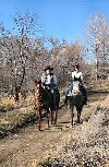
- Visitor access restrictions significantly beyond the "least restrictive" required by the VMP
- Bikes and dogs are excluded from the HCA
- Equestrians are excluded from the permit process in the HCA
- Dogs are required to be on trail and on leash in the Springbrook NA
- Equestrians are required to be on trail in the Springbrook NA
- New, large-area seasonal closures are proposed in the Community Ditch and Flatirons Vista NA
- Inappropriate and/or premature undesignated trail closures
- Undesignated trails would be closed prior to the construction of corresponding designated trails
- All undesignated trails would be closed in "study" areas and other areas without any designated trails
- Quality of visitor experiences marginal
- The Plan would deliberately exclude access to desirable view points:
- Lindsay Pond
- Flatirons Vista overlooks
- A significant portion of the designated alignments (7.4 miles) are roads, not trails
- Community Ditch access road
- Denver Water access road
- Defunct railroad grade
- Flatirons Vista & Doudy Draw farm roads


1 comment:
Hi, I am just writing to inform you that the Lindsay Pond protected wetland area has been destroyed. Go take a look at it. It seems that very large amounts of water have been diverted from the nearby water pipe. There is a lot of construction going on at the water pipe nearby.
Post a Comment